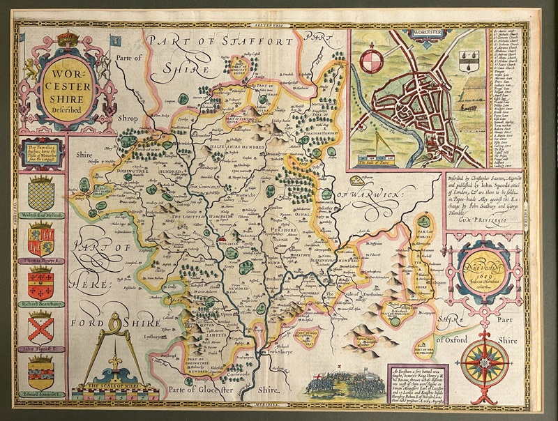
John Speed's 1611 map of Worcestershire.
The University of Birmingham Map Library – also known as the Peart Collection – comprised a number of maps and atlases held by the School of Geography, Earth and Environmental Sciences.
The Map Library was disbanded during 2023 and those items deemed to be ‘Special Collections’ were subsequently transferred to the Cadbury Research Library. The maps and atlases have subsequently been divided into two collections with loose sheet maps forming an archive collection and atlases and bound volumes joining the Rare Book collections.
Loose map sheets have been catalogued with the collection reference MAP and can be searched via our online archive catalogue. This collection contains maps from the sixteenth century to the twentieth century primarily focusing on Birmingham and the West Midlands, but with additional maps from across the United Kingdom and the world. The collection holds a variety of different maps, including county maps by John Speed and Christopher and John Greenwood, Ordnance Survey maps, city and estate maps, transport and political maps, and Goad Fire Insurance maps.
For further information contact us via email: special-collections@contacts.bham.ac.uk